ParcelVision
How to Find a Property Survey Online
You can often find your property survey or plat map online by searching your County Recorder or County Clerk's website. Most counties provide digital portals where you can search for a property by address or parcel ID to view recorded survey documents and plats.
If you're planning a home improvement project or building a fence, the first thing you need is your property survey. But where is it? If you didn't receive a physical copy when you bought your home, your best bet is to look for it in the digital public record.
Here is a step-by-step guide to locating your property survey online without leaving your home.
1. Visit Your County Recorder’s Website
The County Recorder (sometimes called the Register of Deeds or County Clerk) is responsible for keeping all land records. Most US counties have moved these records into searchable online databases.
- Search: Google "[Your County] Recorder of Deeds online search."
- Identify: Look for the "Public Records" or "Document Search" portal.
- Details: You will usually need your address or your **Parcel ID (PIN)** to find the relevant files.
2. Look for the Plat Map
In many cases, a full individual "survey" isn't recorded, but the **Subdivision Plat** is. This is a scaled drawing of your entire neighborhood that shows the exact dimensions and boundary lines of your specific lot.
Plat maps are official documents. While they don't show your house's footprint, they are the legally defining document for where your property lines fall. We have a guide on how to read a plat map once you find yours.
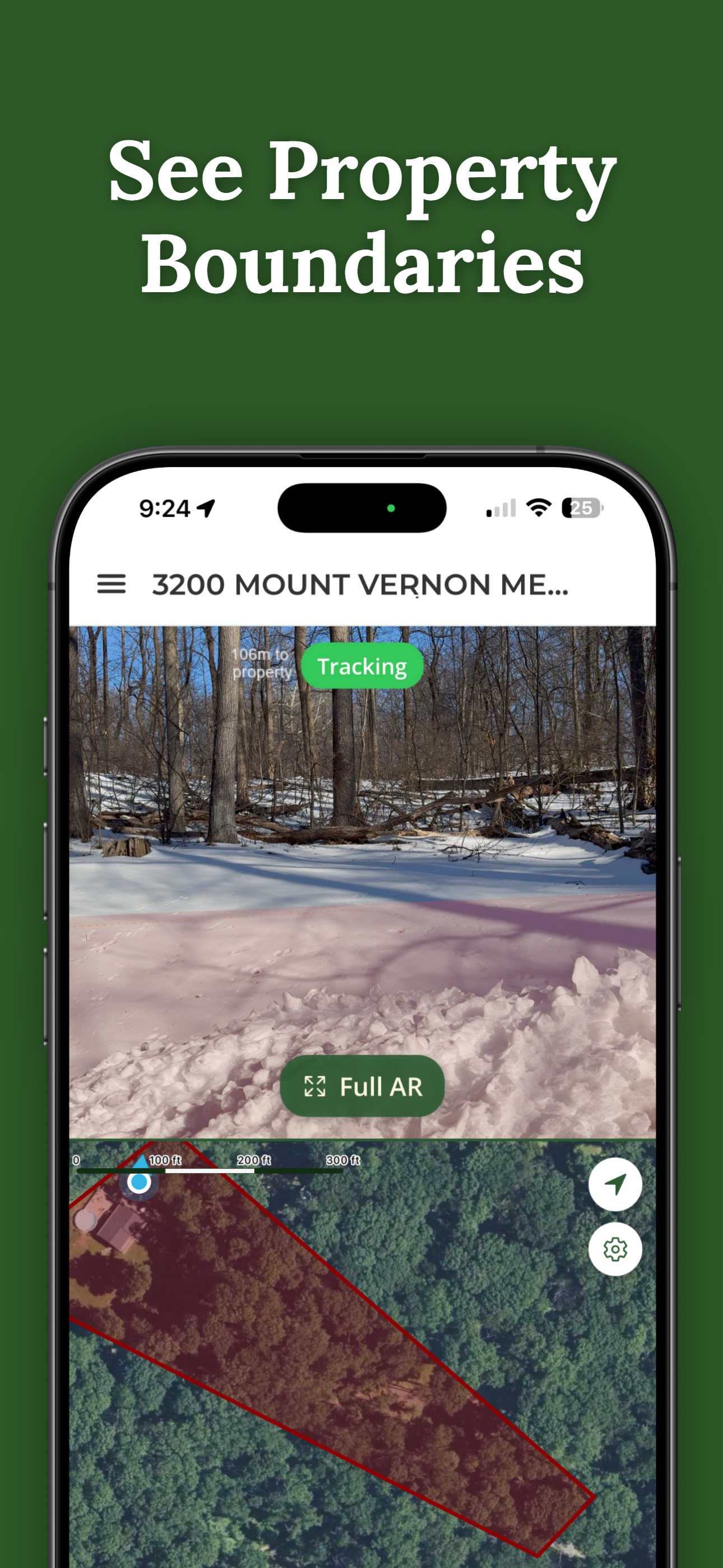
Found the Map? Now See the Lines.
Once you have your dimensions from the survey or plat, ParcelVision helps you find those lines in the real world. Point your camera at the ground, and we'll overlay the boundary lines in AR so you can walk them today.
Download ParcelVision3. Check the County GIS Portal
If the Recorder’s site is hard to navigate, try the **County GIS (Geographic Information System)**. GIS portals are map-based and often allow you to "layer" parcel lines on top of satellite imagery.
Look for a button labeled "Layers" and ensure "Parcels" or "Tax Maps" is checked. This won't give you a certified survey document, but it will give you a very accurate visual representation of your boundaries. You can find more info in our guide to finding property lines online for free.
4. What if the Survey Isn't Online?
If your county hasn't digitized its records yet, you may still have a few options:
- Your Title Company: If you recently purchased your home, the title company likely has a copy of the survey in their closing package.
- Local Building Department: If a previous owner ever applied for a building permit (for a pool or addition), they were required to submit a survey. The building department may have this on file.
Important: An online plat map or GIS rendering is a great tool for planning, but it is not a "certified" land survey. If you are in a legal dispute, you should always hire a licensed surveyor to perform a fresh boundary survey.