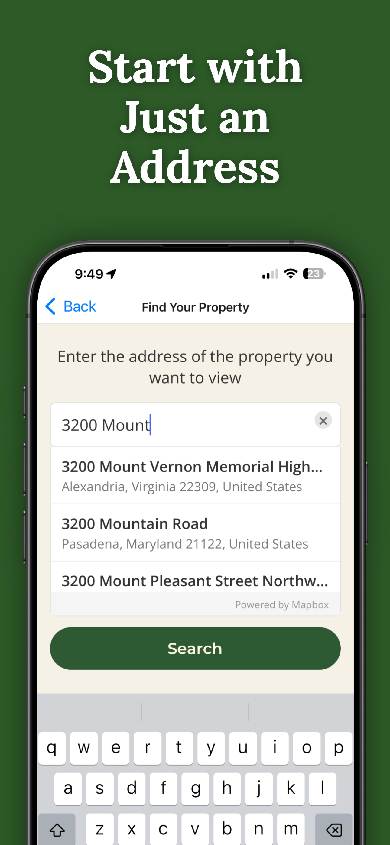
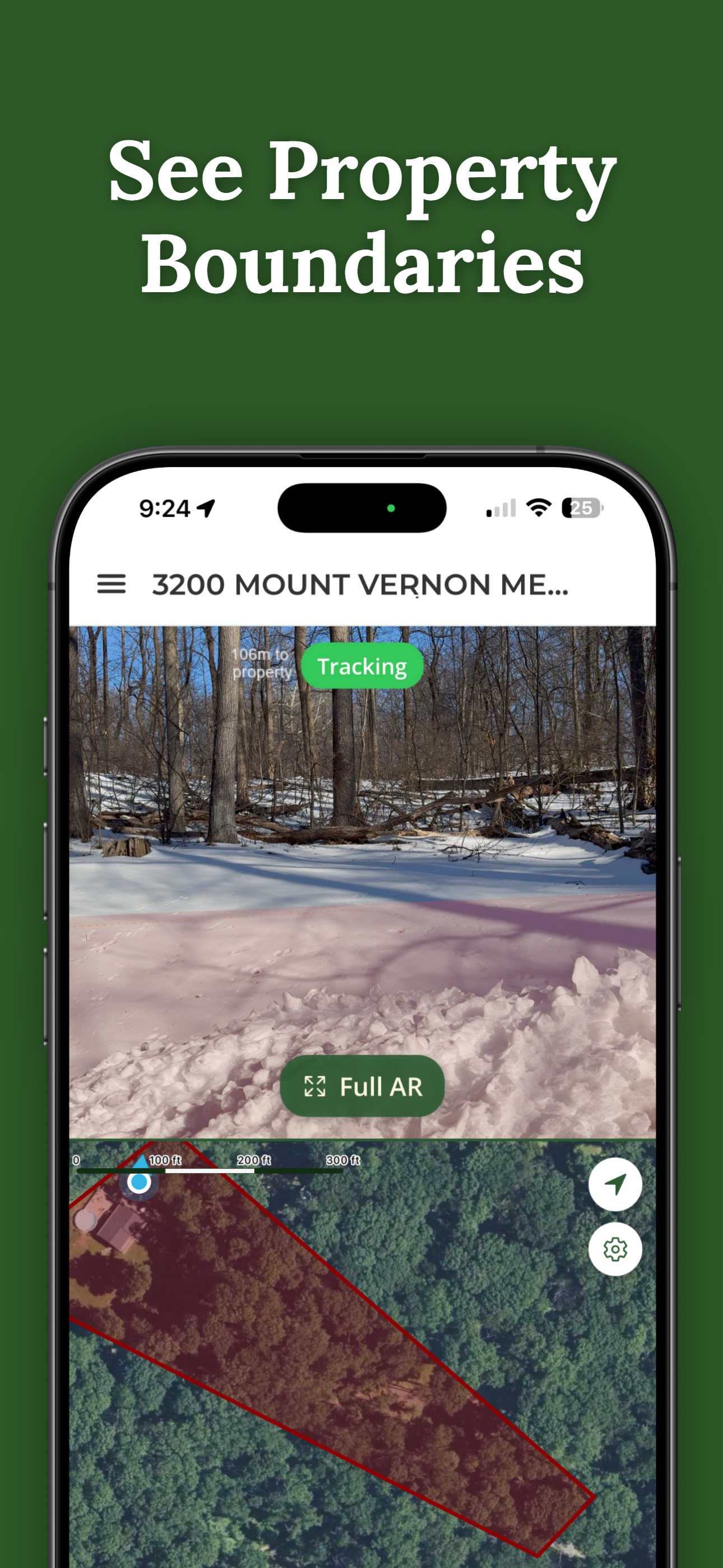
Instantly show buyers where their property begins and ends — no maps or guesswork.
Need help first? Visit support.
One-time purchase per property. No subscription.
On a computer? Scan with your iPhone camera.
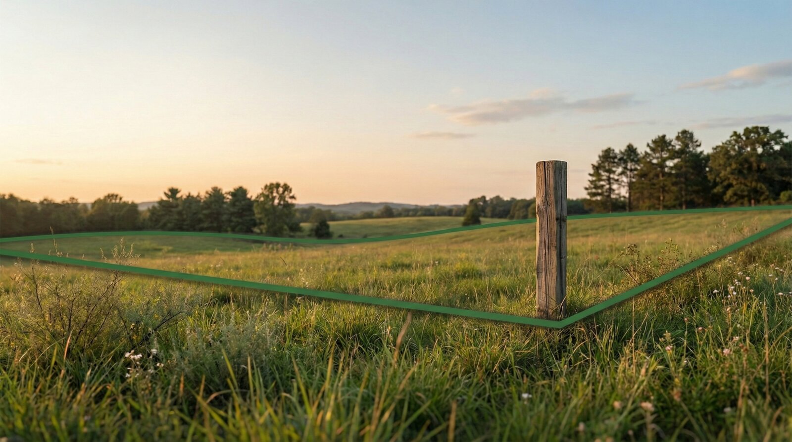
Standing on a 15-acre lot. Buyer asks "where does my property end?" You point at a tree line and hope for the best.
"Hey, the neighbor says my fence is on his side. What do I do?"
You showed them the map. They nodded. They didn't understand.
"It's somewhere around that oak tree... I think."
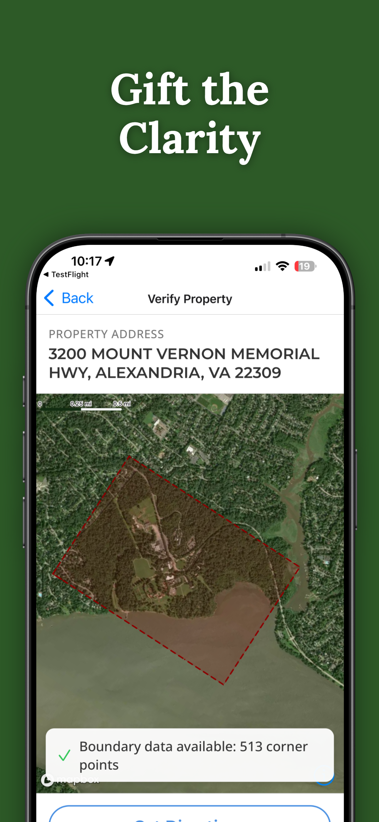
Gift buyers permanent access to their property boundaries.
Help buyers visualize exactly what they're purchasing.
Show land boundaries without confusing technical maps.
It's simple, professional, and memorable — and it costs less than a yard sign.
30 seconds on an actual property — no demo, no animation.
Purchase access for $14.99 per address.
Send a secure access link via text or email.
They view boundaries on-site at no cost to them.
No subscriptions. No buyer accounts. No ongoing fees.
ParcelVision uses public parcel data to visualize approximate property boundaries. It is not a substitute for a professional land survey. You can confidently tell your buyers up front exactly what it is — a helpful visual tool, not a legal document.
You pay once. They keep access forever.
ParcelVision is available now on the App Store.
Download for iPhoneOn Android? We're working on it.
We'll email you once when the Android version launches.
Give buyers a gift they'll actually use.
Gift a Property VisualizationNeed help before you download? Visit support.
On a computer? Scan with your iPhone camera.
ParcelVision provides boundary visualization for reference only and does not replace a professional land survey.
 ParcelVision