ParcelVision
How to Walk Your Property Lines
At some point, every landowner needs to actually walk their lines. Maybe you're planning a fence, marking trees before a timber harvest, setting up for hunting season, or just tired of not knowing where your land actually ends. Whatever the reason, there's a real difference between seeing your parcel on a map and standing on the boundary with your own two feet.
The good news: walking your lines used to require a surveyor or an afternoon of compass-and-tape work, and now it mostly doesn't. Here's how people do it today — the traditional way, the app way, and how to mark what you find so you only have to do this once.
Why Walk Your Lines at All?
A map tells you the shape of your property. Walking it tells you everything else — that the old fence is eight feet inside your line, that your neighbor's deer stand isn't on their side, that the creek crossing you assumed was yours isn't. Common reasons to make the walk:
- Before building a fence. Fence disputes are the most common boundary fight there is, and nearly all of them start with someone guessing.
- Before buying land. Walking the boundary before closing is the single best way to understand what you're actually getting.
- Before a timber harvest. Cutting a neighbor's trees — even by accident — can cost you double or triple their value in damages in many states.
- Before hunting season. Knowing exactly where your land ends keeps you legal and keeps the peace.
- When something feels off. If a neighbor's project is creeping toward your side, walk the line before you start a conversation about it.
The Old Way: Deed, Compass, and Tape
The traditional method starts with your deed's legal description — a series of bearings and distances like "N 42° E, 310 feet" — and a known starting point, usually a recorded corner monument. From there you follow each call with a compass and measure each leg with a tape or by pacing.
It works, and for generations it's how rural landowners did it. But it's slow, it compounds error with every leg, and it assumes you can find that first corner — which, if your pins are buried or missing, is a project in itself. We've got a separate guide on finding property pins and markers if that's where you're stuck.
The App Way: Your Boundary On the Ground
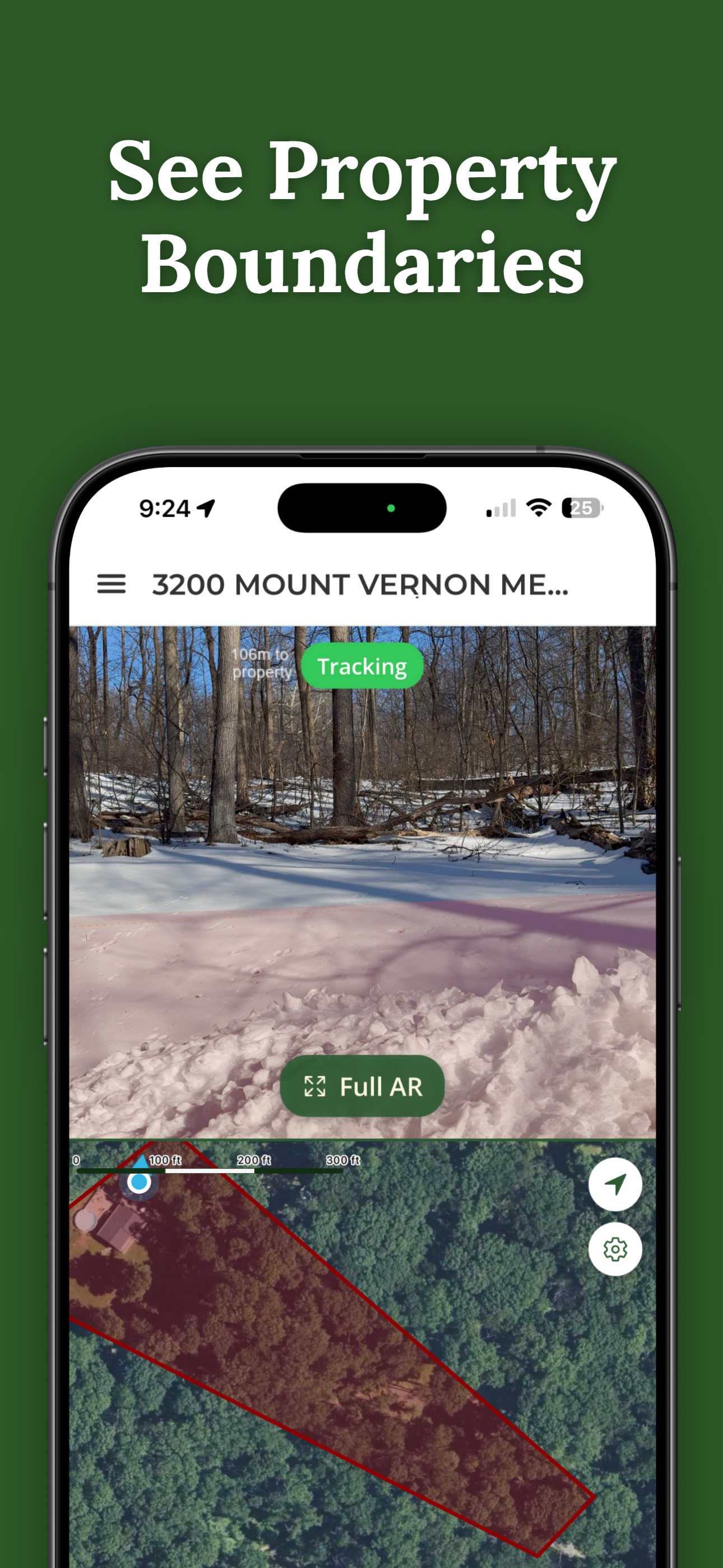
GPS property line apps changed the whole exercise. Instead of translating deed bearings in your head, the app pulls your parcel's recorded boundary from county records and shows it on a satellite map with your live GPS position on it. Walking the line becomes a matter of keeping your blue dot on the boundary.
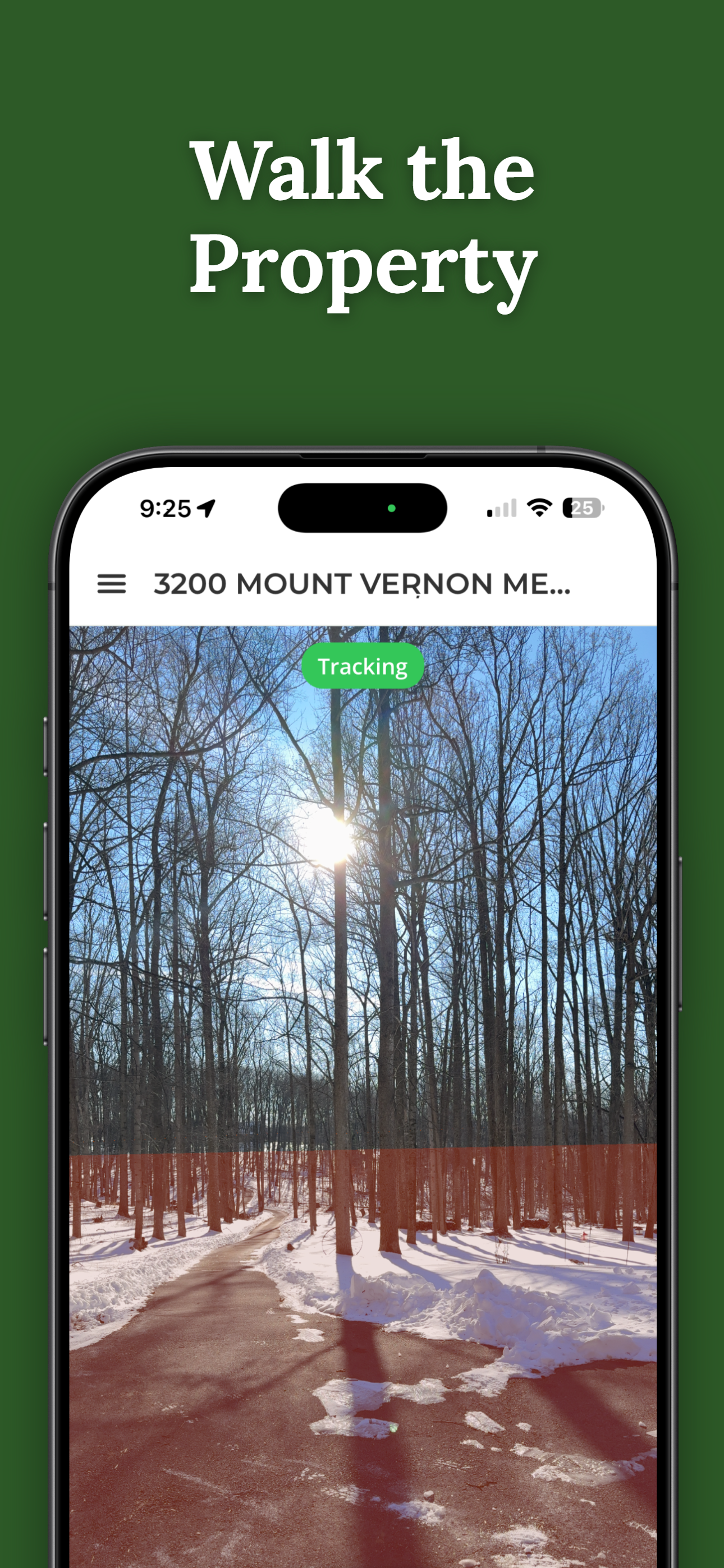
ParcelVision takes it one step further: it draws the boundary line on the ground in front of you, in your phone's camera view, and shows a live readout of how far you are from the line — "42 ft inside your line" — as you move. You're not interpreting a map while you walk; you're following a line you can see.
A Step-by-Step Boundary Walk
- Pull up your parcel before you leave the house. Look at the shape, note the corners, and plan a route. Most parcels are walkable along the boundary; some corners are easier to approach from a road or trail.
- Start at the most findable corner. A road frontage corner is usually the easiest — it's often marked and accessible.
- Follow the line, not the landmarks. Old fences, tree lines, and mowing patterns are where boundaries are assumed to be, not where they are. Trust the line.
- Slow down at corners. Corners are where the important decisions live — and where errors in old fences show up. Take your time and look for physical markers.
- Expect some GPS wobble. Consumer GPS is accurate to roughly 10–30 feet depending on conditions. If the line seems to drift a few steps, stand still for a moment and let your position settle. Tree cover and terrain matter.
Mark What You Find
The walk is worth much more if you leave a record behind. Flagging tape on branches, painted T-posts at corners, or a fence stake where you'll want one later — physical marks turn one walk into a permanent reference.
Digital marks work too. ParcelVision's Pro Tools let you drop GPS waypoints as you walk — a corner, a pin you found, the spot where the neighbor's fence crosses — and navigate back to any of them later with an on-screen heading. If you manage the land for hunting, you can also set boundary alerts that notify you before you cross a line.
How Accurate Is This?
Two things limit accuracy: your phone's GPS (10–30 feet, better in the open, worse under canopy) and the county's parcel data itself, which is mapped from records and varies in quality by county. That's plenty for planning a fence line, staying oriented in the woods, or knowing which side of a line a tree stand sits on. It is not survey-grade, and no app is — we break down the details in how accurate property line apps are.
When to Call a Surveyor
If you're about to build permanently on or near a line, settle a dispute, or need something you can take to court or the county, hire a licensed surveyor. A survey is the only legally recognized determination of where your boundary is. The walk tells you what's worth surveying; the surveyor makes it official.
Walk Your Lines With the Line In View
ParcelVision shows your boundary on the ground in your phone's camera view, with a live distance-to-line readout as you walk. Search your address free, then walk your lot with the line in front of you.
Download ParcelVisionFree to download and search. See your first boundary on the ground for $14.99.
This article is for informational purposes only. ParcelVision is a visualization aid, not a legal survey — boundary data comes from public records and GPS accuracy is not survey-grade. For legal boundary determinations, hire a licensed surveyor.