ParcelVision
Best Hunting Apps That Show Property Lines (2026)
Every hunting app worth installing shows property lines now. The differences are in what you're looking at when you need the line, what it costs every year, and whether it still works when you're standing in timber with no signal and the line runs somewhere in front of you.
Here are the apps hunters actually use for boundaries, with their published prices, and an honest read on which one fits which kind of hunting.
Two Ways an App Can "Show" a Property Line
On a map. onX Hunt, HuntStand and LandGlide draw parcel lines over a satellite or topo map, with a blue dot for you. That's ideal for scouting a region from your couch and for seeing who owns what across a county.
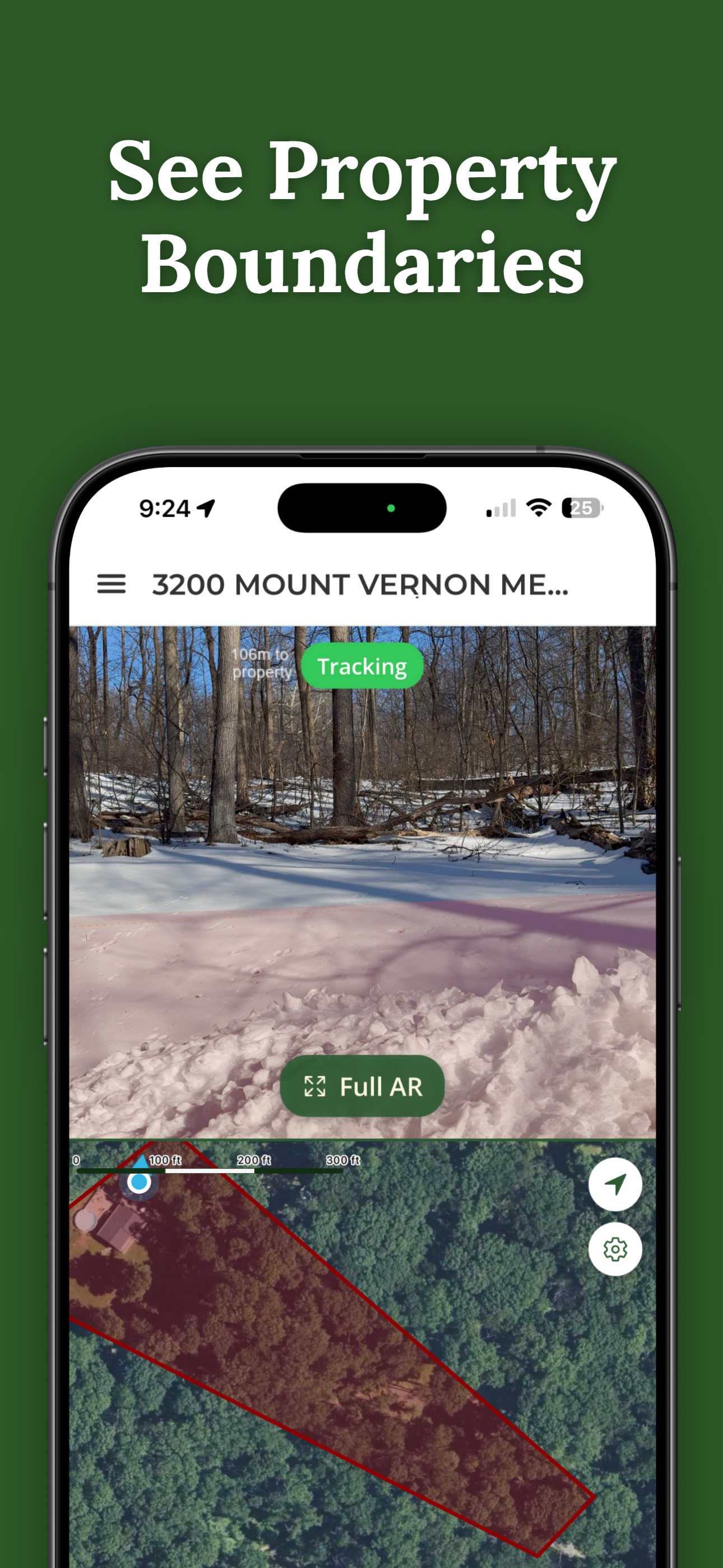
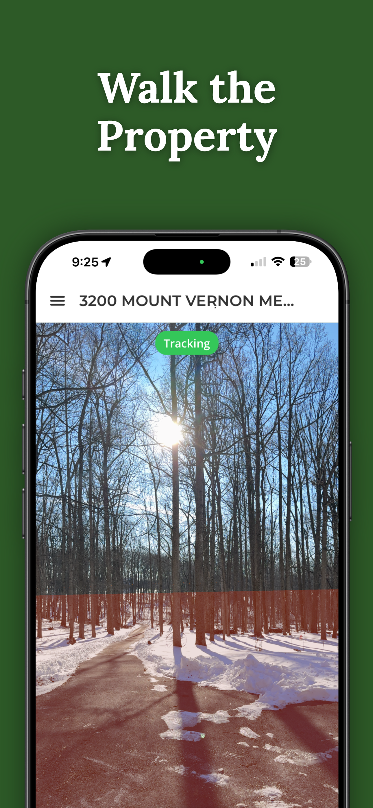
On the ground. ParcelVision draws the boundary through your phone camera as a painted line on the ground ahead of you, so you see the line itself among the trees instead of working out where a blue dot sits relative to a line on a map. That's built for the property you actually hunt: hanging stands, walking the edge, and knowing which side of the line a deer went down on.
Plenty of hunters use one of each.
The Apps
onX Hunt
The default for hunters who move around. Private parcel lines with landowner names, public land, hunting units, offline maps and waypoints across the country. Property lines come with a membership: Premium covers one state for $34.99 a year, and Elite covers every state for $99.99 a year. Best for public-land hunters and anyone who hunts in more than one place.
HuntStand
A strong onX alternative with a big whitetail following. HuntStand's Pro tier, $34.99 a year, includes property boundaries and U.S. ownership data. Ultimate, $99.99 a year, adds its extra hunting tools on top of everything in Pro. Best for whitetail hunters who want stand management and weather tools alongside parcel lines.
LandGlide
Not a hunting app, but hunters use it for fast owner lookups: tap a parcel, see who owns it. $9.99 a month or $99.99 a year. Best for finding a landowner to ask for permission.
ParcelVision
The one that puts the line on the ground. Search any address or tap the map for free; if the parcel has boundary data, unlock it for $14.99 once, with no subscription. Your Virtual Boundary shows the line through the camera as you walk, works without cell service once the property is saved, and can be shared with your hunting partners for free. An optional one-time Pro Tools upgrade adds boundary alerts, waypoints for stands, measurements, a setback line and GPX/KML export into any mapping app that imports those files. Best for the one or two properties you hunt every year.
Side by Side
| App | How you see the line | Cost, year one | Every year after |
|---|---|---|---|
| ParcelVision | On the ground, through the camera | $14.99 once per property | $0 |
| onX Hunt | Map overlay | $34.99 (one state) – $99.99 | $34.99 – $99.99 |
| HuntStand Pro | Map overlay | $34.99 | $34.99 |
| LandGlide | Map overlay | $99.99 | $99.99 |
Prices are each company's published annual rates as of October 2026. Monthly billing costs more where offered.
Which One Should You Get?
- You hunt public land, or several states: onX Hunt. Its public-land and unit layers are the reason to pay every year.
- You hunt whitetails on a few farms and want stand tools: HuntStand Pro.
- You hunt your own land, a family farm, or a lease: ParcelVision. You pay once for the property you hunt every season, and you can see the line from the stand instead of guessing at it.
- You need to know who owns the next field over: any of the map apps, or your county's free parcel viewer.
The common setup for private-land hunters is a map app for the big picture and ParcelVision on the property itself. Export your boundary and stand waypoints as GPX or KML and they'll sit on your map app too.
See the Line From Your Stand
Search the property you hunt for free. If boundary data is there, unlock it once for $14.99 and see the line on the ground all season, signal or not.
Search Your Hunting Property FreeFree to download and search. One-time $14.99 per property. No subscription.
This article is for informational purposes only and isn't legal advice. Hunting, trespass, posting and safety-zone rules vary by state and municipality and change over time; check your state wildlife agency and local ordinances. Competitor prices are as published by each company in October 2026. ParcelVision is a visualization aid, not a legal survey.